Sunday, July 25, 2010

Merton Lake July 24, 2010

I didn't get to go out last weekend due to a nasty summer cold, so I had to make up for it this weekend.  My friend and I ventured out to a place I hadn't visited yet - Merton Lake.  It has been on my list for a while.  Merton Lake is located about 25km down the 200 Road, which is just off the highway in Bear Lake.  It is a gravel road, but is in good shape, so there was no problem getting there in my car.

The water was choppy and it was a bit windy when we arrived.  We unloaded the boats and got on the water, hoping the wind would die down.

We headed south from the recreation site, along the shoreline, into the wind.  After attempting to stop and take some pictures, and getting the boats swamped, we decided to head back to the rec site and wait out the wind.


We practically rode the waves back to our starting point, but once we got there, the wind died down a bit, and the waves seemed smaller, so we stayed out on the lake, this time paddling north.

The water at the north end of the lake was much calmer, so we paddled around the reeds and grasses for a bit.

It seems that every lake I go to has some kind of flower I haven't seen before.  These little white ones were all over this area.


We found a little stream meandering through the reeds, and followed it as far as we could.  We couldn't get past this stump due to beaver activity, so we turned around and headed back to the lake.


We managed to follow the shorline around a few more bends, and then made our way back to the rec site.  Just as we reached the shore, the wind picked up again. 


One the way home, we stopped at the Crooked River to take a few pictures. All in all, it was a good trip, but hopefully the next time I'm at Merton Lake, it will be calm enough to see more of it.

Monday, July 19, 2010

Stuart Lake, June 12th, 2010

Okay, I'm going back in time a bit here, since I was at Stuart Lake about a month before St. Marie and Davie Lakes, but I wanted to post this anyways.

I spent many weekends as a child camping on Sturat Lake, at Parrens Beach, and Sowchea Bay, and I know how fast the winds can pop up and ruin a person's day on the water.  I was a little reluctant to take my little boat out on this massive lake, but it was relatively calm when I got there, and there was plenty of beach to stick close to just in case the weather turned ugly.

I started out at Parrens Beach campground, and headed west along the shore to the little estuary where Sowchea Creek flows into the lake.


This is a view of the hills on the northern shore.  I think that may be Mount Pope (not 100% sure).

The trees along the beach looked like they should have fallen over a long time ago.
There was a lot of driftwood in some spots.


This is the entrance to the estuary. 

Once inside, it was beautiful.  Such calm water, and so many birds singing.  There was an eagle's nest in one on the trees just to the right of the bow.

There's a better picture of it...

One of the things I love about being in a kayak is the ability to fit through small spaces.  I had to take a bit of a run at this one...
....But I made it!  I turned around at this point, as this was the end of this little reach, and lily pads that thick are difficult to paddle through.

Such pretty reflections.  That little sandy strip of land was all that was separating this part of the estuary from the actual lake.  
The rain clouds were getting closer, so I headed back along the beach to my starting point.  I was lucky to get a nice break in the weather, because not too long after I got off the water, it got ugly.

This is the Stuart Lake I remember from my childhood.  Crazy wind and big waves that will swamp a boat that is moored too close to shore and fill it with gravel.  Definitely not a lake I would take my kayak out on.  So I am glad to have had a small window of good weather to explore a part of it.

Saturday, July 17, 2010

Davie Lake July 10th 2010

Davie Lake
July 10, 2010

Davie Lake is located just outside the town of Bear Lake, about 75km north of Prince George.  It is part of the chain of lakes along the Crooked River.  The road from the highway to the lake is in rough shape, but is only about 3km long, so if you take it slowly, it's accessable in a car.


There are a lot of lily pads right off the boat launch at the rec site.  It is a shallow lake at this end, and there are so many varieties of lake vegetation that can be seen from above the water.

There were a few powerboats and sea-doos out on the open part of the lake, so we headed to the southern end where it is shallow and swampy to get away from the noise.  There is a small portion of the lake that is only accessible by stream, so it is much more peaceful.  :)  This is the start of the swampy area before the stream.

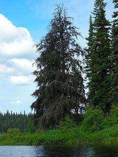
I think the bug is a dragon fly larva.  It looked interesting.  And even though most of the trees close to the lake are still green, there are a few dead pine around.  Can't seem to get away from that in this part of the province.


And I love an interesting stump.  I thought this one kind of looked like a deer with antlers.  After a small time in this portion of the lake, we headed back to explore the Crooked river.  

There were so many pretty
water plants in bloom.


Heading upstream on the Crooked River, from the south end of Davie Lake.  The water was beautifully calm, and the current is only noticeable if you stop paddling.
That's Teapot Mountain in the background - barely visible above the brush on the riverbank.
There were several patches of ferns up on the banks.  It had a bit of a tropical feel.


Beautiful, calm water! 


I call this one "Alien Stump."

We turned around and headed back shortly after this point.  The river twists and winds a lot, and there are oxbows on parts of it, so it is easy to get turned around.  That's what the GPS is for!


Paddling downstream.  The trip back was a bit faster, and easier to paddle.  I guess there was a bit of a current afterall.


Back on Davie Lake, looking North.  There is still so much of this lake to explore!  The Crooked River not only flows in at the south end of the lake, but it also flows out at the north end.  Since it is a rather large lake, I will have to leave that part of the Crooked River to explore another time.
St. Marie Lakes, June 19th 2010

The St. Marie Lakes are a short drive southeast of Prince George.  There are two lakes in the chain, and they are connected with a short stream.

It was a beautiful, sunny day, with a bit of a breeze.  We went out in the late morning, and started out at the eastern of the 2 lakes.


There are many rock formations along the northern shore which make for great photographs!


Once we paddled into the stream the water calmed down considerably.  It was a very marshy area.      
There was a bit of debris in the stream.  These logs were all over the place. They were all perfectly rounded, and some had metal spikes sticking out of them. They had been there long enough for plants to grow on them.  It kind of looked like a cabin had just tumbled into the swamp and broken apart.
Back into the stream for the trip home.  Lots of calm water and pretty views.